Some earthquakes shook Indonesian territories lately. Recently, a 7.9 magnitudes earthquake occurred in the Tanimbar Islands Sea, Maluku, Tuesday, January 10, 2022, early morning. BMKG had issued a tsunami early warning which ended after 3 hours.
The earthquake that occurred at 00.47 West Indonesia times was located at 7.25 South Latitude and 130.18 East Longitude. This earthquake has a depth of 131 kilometers. The earthquake point occurred 150 kilometers northwest of West Southeast Maluku.
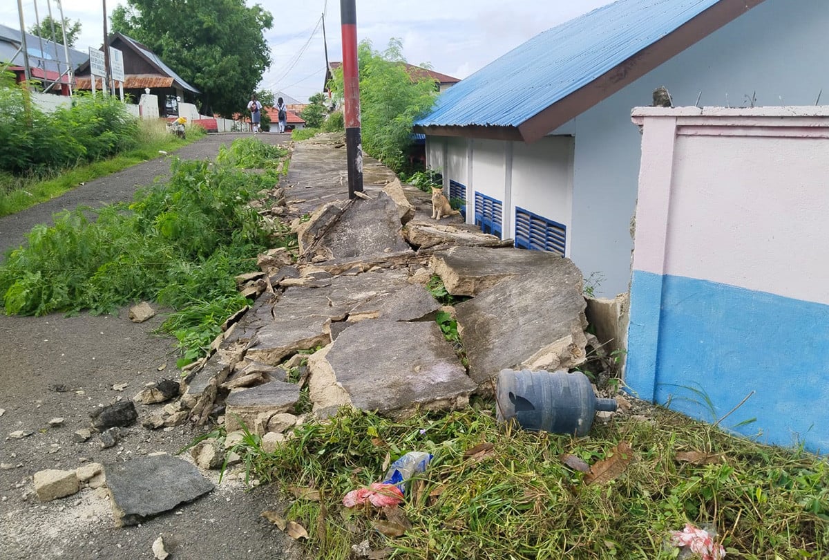
Because of the hard shocks that occurred, several houses and public facilities were damaged. Some houses are flattened on the land of Saumlaki, the capital of the Tanimbar Islands Regency (KKT) due to earthquake shocks. In addition to residents’ homes, a pearl company building on the coast of Saumlaki beach also collapsed.
It is known, after the earthquake occurred, BMKG issued a tsunami early warning. The tsunami early warning covers the Maluku and Southeast Sulawesi regions.
“Tsunami early warning for regions: Maluku, Southeast Sulawesi,” said information on the official BMKG website as seen on Tuesday (10/1/2023).
The MKG ended the tsunami early warning after the 7.5 earthquakes occurred in West Southeast Maluku. The status of this tsunami’s early warning ended after 3 hours after the earthquake occurred.
Based on the analysis, BMKG said the strong earthquake was triggered by a plate in the Banda Sea. This earthquake is a type of medium earthquake.
“The submission of the Banda Plate (Sea),” BMKG Daryono’s earthquake and tsunami head, told reporters on Tuesday (10/1/2023).
Furthermore, BMKG updated the earthquake power that occurred in West Southeast Maluku. The previous earthquake with M 7.9 magnitude is now updated to M 7.5.
“The results of the BMKG analysis show that this earthquake has an updated parameter with magnitude M 7.5. The epicenter of the earthquake is located at the coordinates of 7.37 Ls; 130.23 BT, or precisely located at sea at a distance of 136 km northwest of West Maluku from West Southeast Maluku, Maluku, at a depth of 130 km, “said Head of the BMKG Daryono Earthquake and Tsunami Center, Tuesday (10/1/2023).
